

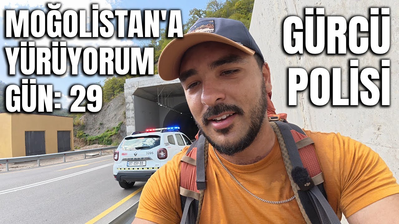
On the 28th, 29th, and 30th days of my walk from Turkey to Mongolia, I crossed right through the heart of Georgia: from Zestafoni to Ubisa, from Ubisa over the Rikoti Pass to Surami, and then down into the plains to Agara. I walked about 95 kilometers in three days. This stretch included the hardest day of the journey so far, a policeman who stopped me on the highway, and a mountain pass full of tunnels. In this post, as I recount those three days, I also share what I learned about routes, food, accommodation, and safety for anyone wanting to travel through Georgia on foot or with a backpack.
Watch the Video: Day 28, From Zestafoni to Ubisa
Day 28: To Ubisa via the Old Road with Soviet Traces
Zestafoni is a lively town. The main road to Tbilisi passes through here, but there is also an old road alongside it. I chose the old road. The distance was only a few kilometers longer, and in return, instead of the sound of cars, I got birdsong, a railway, a river, and a forest. I bought grapes on the way and ate them as I walked.
This road showed me the Soviet era step by step. Rusty pipes, half-finished walls, buildings resembling old railway quarters, a demolished bunker. Everything is functional and colorless. If you drive through, you wouldn't see these; if you cycle, you wouldn't stop to look. But walking, it all flows slowly before your eyes. For the first time in my life, I passed under a train track, and then joined the road from the foothills of Shorapani Castle.
One thing I learned from the people I talked to on the road was interesting: most people over 30 in Georgia know Russian because they learned it in school, but young people are not very keen on learning Russian because they feel closer to Europe. The mother of the family I stayed with at the previous house advised her daughter, who speaks four languages, to learn Chinese. I also saw the influence of China in the country on the road: "Made in China" was written on the bridges.
Honey and Water: My Formula for Energy on the Road
I carry honey with me on long hikes, but it's hard and heavy to eat from a jar. During breaks, I pour plenty of honey into an empty 1.5-liter bottle and shake it with water. It lightens my bag and gives me an energy drink that carries me for 10 kilometers. If you are going on a long hike, try this.
Dinner and a Pitch-Black Road
As I approached Ubisa, I entered a restaurant whose sign I had seen everywhere along the road. A garlicky, juicy fried chicken arrived. I have never seen that much garlic in one place in my life. In Georgian cuisine, chicken with garlic sauce is called chkmeruli; my plate was very similar. I drank local lemonade with it. These sodas with fruit or herbal flavors, which are drunk a lot in Georgia instead of cola, tasted a bit vegetable-like to me. I paid a total of $15 for the food, drink, and bread.
After the restaurant, I had a half-hour walk left, and even though it was only 7:30 PM, it was pitch black outside. There are no street lamps. The only light was the moon and my headlamp. Even the sound of a small rolling stone made me jump. Finally, I arrived at the guesthouse in Ubisa and stayed there for two nights.
Watch the Video: Day 29, From Ubisa to Surami
Day 29: Crossing the Rikoti Pass on Foot
I had a hot breakfast in Ubisa: eggs, tomatoes, and cheese. The tomatoes taste different in Georgia. Then I set off at 7 AM because I had the hardest day of my Georgia route ahead of me: the Rikoti Pass.
Rikoti is a mountain pass about 1,000 meters high that connects western Georgia to the east. The main road between Kutaisi and Tbilisi passes through here. The new highway pierces the mountains with tunnels, but I had to take the old roads because I didn't want to go into the tunnels. I also learned on the road that this place is difficult to cross in winter.
1. Village Roads Instead of Tunnels
In the morning, I passed in front of the old church in Ubisa. Its door was closed, but even from the outside, you could tell how old it was. Ubisa Monastery is a historical site known for the wall paintings inside; if you go during the day, try to see the inside. Then I went along the highway and plunged into village roads. I found the path and forest roads that Google Maps doesn't show thanks to Maps.me. This application also shows roads that cars don't pass on with a dotted line; it is one of the best tools for those traveling on foot.
2. The Moment I Had to Get on the Highway
At one point, the village roads ended, and the only option was the highway. I asked the workers on the road, and they said, "You can walk." I walked along a closed lane, next to the barrier. I don't recommend this part to anyone. Walking on the highway is dangerous, and the rules are different in every country. What I saw was: villagers selling mushrooms and milk on the side of the highway, shepherds grazing their cows. A police car passed me, didn't say anything. A second one turned back and stopped in front of me. For a moment, I thought, "I'm going to get fined," but when I asked if walking was a problem, the police said, "No problem, good luck." They were surprised when they heard where I was going and took a photo with me. I felt relieved.
3. Bypassing the Rikoti Tunnel
I bypassed the approximately 2-kilometer tunnel at the top of the pass using the old road on the left. This road added about an hour to the trip, but I walked through the forest, in the fresh air. At the top, I saw the remains of restaurants and rest areas that once served travelers; nature had reclaimed them all when the new road opened. The tunnel construction camp and Chinese workers were also here. You really see Chinese engineers and workers everywhere in Georgia.
4. Cheap Fish on the Descent and Surami
On the descent, I ate two large whitings, salad, and pickles at a roadside diner. With soda and water, I paid 20 Lari, which was about 6.5-7 dollars at the time. I arrived in Surami in the late afternoon. At the end of the day, my watch showed 36.8 kilometers, 46 floors of climbing, and nearly 50,000 steps. It was the first day of this journey when I thought, "Something is going to happen to my knee, I won't be able to pass this pass." I made it, but the price was a toenail.
Watch the Video: Day 30, From Surami to Agara
Day 30: From Mountains to Plains, 28 Kilometers to Agara
The ground floor of the house I stayed in in Surami was a wine cellar. The large clay pots, or qvevris, that I saw in many houses in Georgia were also here. Grapes are placed in these pots and fermented, and this is how winter wine is made. Wine making with qvevri is on UNESCO's list of intangible cultural heritage.
The temperature was 10 degrees in the morning, and everyone was wearing coats. I passed through Surami's castle, the neighborhood church, and the neighborhood where an old synagogue is located. The view was like a painting with the sun coming out after the rain. On the road, I saw trees with smooth, gray trunks that looked like beech trees. The tree considered sacred in the old beliefs of the Turks is usually referred to as beech; however, in Altai and Central Asian Turkic languages, "kayın" mostly describes the birch tree.
A Flat Country After Rikoti
After crossing Rikoti, the geography of Georgia changes completely. The mountains shrink behind you, and wheat and corn fields, cow and goat herds open up in front of you. This plain stretches towards Azerbaijan and the Caspian Sea. I proceeded on the quiet side roads next to the railway and the highway. There are apples, quinces, rosehips, and cornelian cherries on the side of the road. It's hard to go hungry.
Turkish Truck Parks on the Road
At noon, I came across Turkish truck parks lined up one after another along the highway. The signs had names like Akdeniz, Hatay, and Samsun. I went into one and paid $10 for a saç kavurma (pan-roasted meat), salad, pear juice, and bread. It was delicious and affordable. Turkish products and businesses are really very common in Georgia.
Last Minute Accommodation in Agara
The only hotel I could find in Agara had a low rating and bad reviews. I went blindly. There was no one there, I called the number on the door, and I found a room. The room was 80 Lari, which was about 28 dollars at the exchange rate at the time. The curtain was torn, but I lay down my sleeping bag anyway. The snowy mountains across the way were visible from the window. I walked 27 kilometers that day.
Practical Information for Traveling in Georgia on Foot
1. Route and Distances
| Day | Stage | Distance (approx.) | Difficulty |
|---|---|---|---|
| 28 | Zestafoni - Ubisa | 27 km | Medium, undulating old road |
| 29 | Ubisa - Rikoti Pass - Surami | 37-40 km | Very difficult, approx. 1,000m pass |
| 30 | Surami - Agara | 27-28 km | Easy, flat plain |
2. Prices (At the Time We Filmed the Video)
- Khachapuri and coffee: 20 Lari (approx. 6-6.5 dollars)
- 3 bananas, 2 apples, and 5 energy bars: approx. 4 dollars
- Roadside fish, salad, and drink: 20 Lari (approx. 7 dollars)
- Garlic chicken, drink, and bread at a restaurant: 15 dollars
- Saç kavurma menu at a Turkish truck park: 10 dollars
- Hotel room in Agara: 80 Lari (approx. 28 dollars)
Prices and exchange rates change; check the current situation before you hit the road. If you have trouble finding a place to stay, you can check out my guide for cheap accommodation while traveling.
3. Safety
I found Georgia safe for walking. People are sweet, and I didn't experience any negativity for being Turkish in the guesthouses I stayed in. The police checked my passport on the first day I entered the country; in the following days, I felt that police cars were circling me or even trying to give me way. Still, be careful in remote places: I always kept an eye out behind me because of someone I thought was following me one day. There are a lot of stray dogs; if you stay calm and keep walking, most just bark and back off.
4. Weather and Equipment
In autumn, I saw 27 degrees one day, and 10 degrees in the morning two days later. The air gets dark very quickly in the evenings and there is no lighting on village roads. Make sure to carry a headlamp, a spare t-shirt, Vaseline for your feet, and an empty water bottle. I explained what I carry in my travel equipment guide.
5. Internet and Map
I had to be online constantly to find the route on village roads. You can use Maps.me offline, but internet is essential for communicating with the police and hotels, and for route research. You can check the Georgia packages of Yırtık eSIM here.
Frequently Asked Questions
Is it forbidden to walk on the highway in Georgia?
The police I encountered didn't see a problem with me walking near Rikoti, but this is not a rule, it was a permission given at that moment. Walking on the highway is dangerous. Use old roads and village roads as much as possible, do not walk into tunnels.
Can the Rikoti Pass be crossed on foot?
Yes, it can be crossed via old roads and tunnel bypasses. However, it means a steep and long day. I walked about 37 kilometers from Ubisa to Surami and set off at 7 AM.
Can Turkish citizens enter Georgia with an ID card?
As of the date this article was written, Turkish citizens can enter Georgia visa-free with their new-style ID cards. Check the rules from official sources before you go. You can also take a look at my Georgia entry guide regarding entry and Batumi.
What is the best map application for hiking in Georgia?
For me, it was Maps.me. It shows forest roads and paths not visible on Google Maps.
If you want to support this walk, you can check out my book here. In my previous post, I described the difficult days in Hong Kong: Living cheaply in Hong Kong. The next stop of the walk is Gori, Stalin's hometown; I will tell you about the days stretching from there to Tbilisi in my next post.


0 comments